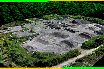
Photogrammetry is the process of obtaining reliable information about the environment and geographical location by recording and interpreting photographic images. Photogrammetry is mostly used in surveying but has applications in other areas including geology, meteorology, and engineering.
This course entails details about these applications.
- 10 Sections
- 31 Lessons
- 10 Weeks
Expand all sectionsCollapse all sections
- Introduction to photogrammetry4
- Photogrammetry in geology4
- Photogrammetry in meteorology3
- Photogrammetry in manufacturing2
- Photogrammetry in topographic mapping3
- Photogrammetry in quality control3
- Photogrammetry in police investigation3
- Photogrammetry in archaeology3
- Photogrammetry in engineering3
- Photogrammetry in architecture3

